Geolocate

Liucheng topographic map

Click on the map to display elevation.

About this map

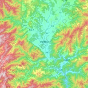
Name: Liucheng topographic map, elevation, terrain.

Location: Liucheng, Wuyi County, Jinhua, Zhejiang, China (28.53281 119.48627 28.70313 119.70278)

Average elevation: 494 m

Minimum elevation: 124 m

Maximum elevation: 1,153 m

Gear up for your next adventure:

🪑Insulated Seat Pad - Protect your seat from cold rocks and wet logs
🧴First Aid Kit - Essential first aid supplies for outdoor emergencies
🧥Packable Rain Jacket - Breathable waterproof layer for unpredictable weather
💧Collapsible Water Bottle - Space-saving water bottle for outdoor activities
💡LED Camping Lantern - Illuminate your campsite with long-lasting lanterns

As an Amazon Associate, this site earns from qualifying purchases at no extra cost to you.