Geolocate

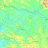
Poovachal topographic map

Click on the map to display elevation.

About this map

Name: Poovachal topographic map, elevation, terrain.

Location: Poovachal, Kattakkada, Thiruvananthapuram, Kerala, 695575, India (8.51671 77.06633 8.55671 77.10633)

Average elevation: 91 m

Minimum elevation: 52 m

Maximum elevation: 194 m

Other topographic maps

Click on a map to view its topography, its elevation and its terrain.

Neyyar Dam

India > Kerala > Kattakkada

Average elevation: 91 m

Amboori

India > Kerala > Kattakkada

Average elevation: 173 m

Poovachal

India > Kerala > Kattakkada > Uriyacode

Average elevation: 84 m

Vellanad

India > Kerala > Kattakkada > Uriyacode

Average elevation: 77 m

Neyyar

India > Kerala > Kattakkada > Keezharoor

Average elevation: 57 m

Sasthampara

India > Kerala > Kattakkada > Vilappilsala

Average elevation: 69 m

Kattachal chira

India > Kerala > Kattakkada > Kattakada

Average elevation: 75 m

Vellanad

India > Kerala > Kattakkada > Uriyacode

Average elevation: 77 m

Gear up for your next adventure:

🥾Light Trekking Boots - Supportive boots for multi-day treks
🏕️Camping Hammock - Integrated protection for sleeping between trees
🛶Kayak Accessories - Essential gear for safe and fun kayaking adventures
🧰Multitool Knife - Compact and versatile tool for outdoor use
🧥Softshell Hiking Jacket - The perfect balance of wind protection and breathability

As an Amazon Associate, this site earns from qualifying purchases at no extra cost to you.