
Make a donation
Gear up for your next adventure:
As an Amazon Associate, this site earns from qualifying purchases at no extra cost to you.
Gommersheim topographic map
Click on the map to display elevation.
Make a donation
Gear up for your next adventure:
As an Amazon Associate, this site earns from qualifying purchases at no extra cost to you.
About this map
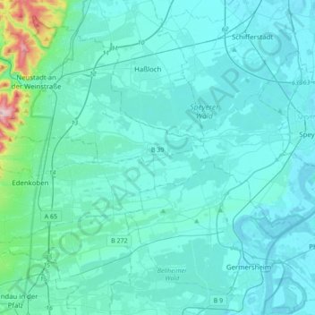
Name: Gommersheim topographic map, elevation, terrain.
Average elevation: 135 m
Minimum elevation: 92 m
Maximum elevation: 605 m
Make a donation
Gear up for your next adventure:
As an Amazon Associate, this site earns from qualifying purchases at no extra cost to you.
Other topographic maps
Click on a map to view its topography, its elevation and its terrain.
Kalmit
Deutschland > Rheinland-Pfalz > Landkreis Südliche Weinstraße > Maikammer
Die Kalmit, seltener auch Große Kalmit genannt, bei Maikammer im rheinland-pfälzischen Landkreis Südliche Weinstraße ist mit einer Höhe von 672,6 m ü. NHN der höchste Berg des Pfälzerwalds und nach dem Donnersberg der zweithöchste Gipfel der Region Pfalz. Der Berg liegt in der Haardt, dem Ostrand des…
Average elevation: 483 m
Prestenberg
Deutschland > Rheinland-Pfalz > Landkreis Südliche Weinstraße > Eußerthal
Average elevation: 325 m