Geolocate

Damietta topographic map

Click on the map to display elevation.

About this map

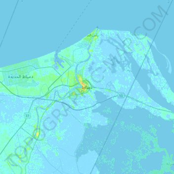
Name: Damietta topographic map, elevation, terrain.

Location: Damietta, 34511, Egypt (31.25674 31.66137 31.57674 31.98137)

Average elevation: 0 m

Minimum elevation: -12 m

Maximum elevation: 17 m

Other topographic maps

Click on a map to view its topography, its elevation and its terrain.

Mit Abou Ghaleb City

Egypt > Damietta

Average elevation: 2 m

Gear up for your next adventure:

🥾Trail Hiking Boots - Supportive boots for rough trails
🧴Insect Repellent - Protect yourself from bugs during outdoor adventures
🧼Travel Hand Sanitizer - Keep hands clean when water is scarce
🗺️Topographic Maps - Detailed maps to explore trails, mountains, and wilderness areas
🧤Insulated Winter Gloves - Heavy-duty protection for sub-zero Canadian adventures

As an Amazon Associate, this site earns from qualifying purchases at no extra cost to you.