Geolocate

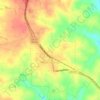
Riverside topographic map

Click on the map to display elevation.

About this map

Name: Riverside topographic map, elevation, terrain.

Location: Riverside, Lancaster County, South Carolina, United States (34.75126 -80.86090 34.79126 -80.82090)

Average elevation: 166 m

Minimum elevation: 133 m

Maximum elevation: 195 m

Other topographic maps

Click on a map to view its topography, its elevation and its terrain.

Gear up for your next adventure:

🧤Thermal Hiking Gloves - Grip-enhanced gloves for cold-weather altitude trekking
⛺Camping Essentials - All-in-one gear for a comfortable camping trip
🔦LED Headlamp - Hands-free lighting for early morning starts or late finishes
🔋Solar Power Bank - Keep your GPS and devices charged during long outdoor trips
⛺Tent Footprint - Protect tent floor and increase durability

As an Amazon Associate, this site earns from qualifying purchases at no extra cost to you.