Geolocate

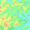
Praça Tancredo Neves topographic map

Click on the map to display elevation.

About this map

Name: Praça Tancredo Neves topographic map, elevation, terrain.

Location: Praça Tancredo Neves, Sede, Contagem, Minas Gerais, Região Sudeste, 32017-900, Brasil (-19.91981 -44.09339 -19.91797 -44.09153)

Average elevation: 928 m

Minimum elevation: 875 m

Maximum elevation: 1,010 m

Other topographic maps

Click on a map to view its topography, its elevation and its terrain.

Eldorado

Brasil > Minas Gerais > Contagem

Average elevation: 910 m

Santa Luzia

Brasil > Minas Gerais > Contagem

Average elevation: 911 m

Cidade Industrial

Brasil > Minas Gerais > Contagem

Average elevation: 925 m

Sapucaias III

Brasil > Minas Gerais > Contagem

Average elevation: 894 m

Colorado 1ª Seção

Brasil > Minas Gerais > Contagem

Average elevation: 897 m

Jardim Marrocos

Brasil > Minas Gerais > Contagem

Average elevation: 927 m

Nacional

Brasil > Minas Gerais > Contagem

Average elevation: 851 m

Vale das Amendoeiras

Brasil > Minas Gerais > Contagem

Average elevation: 855 m

Três Barras

Brasil > Minas Gerais > Contagem

Average elevation: 911 m

Cabral

Brasil > Minas Gerais > Contagem

Average elevation: 858 m

Gear up for your next adventure:

🌬️Windproof Camp Stove - Efficient cooking even on exposed mountain peaks
🗺️Topographic Maps - Detailed maps to explore trails, mountains, and wilderness areas
💡LED Headlamp - Hands-free illumination for night hiking and camping
🥾Trekking Poles - Adjustable trekking poles to reduce knee stress and improve stability
🧥Ultralight Puffy Jacket - Maximum warmth that packs down to the size of an orange

As an Amazon Associate, this site earns from qualifying purchases at no extra cost to you.