Geolocate

Menphis topographic map

Click on the map to display elevation.

About this map

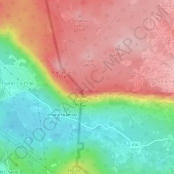
Name: Menphis topographic map, elevation, terrain.

Location: Menphis, Sela na Krasu, Miren-Kostanjevica, 5269, Slovenia (45.82027 13.59815 45.82037 13.59825)

Average elevation: 129 m

Minimum elevation: 11 m

Maximum elevation: 242 m

Gear up for your next adventure:

🛶Canoe Life Vest - Safety vest for water sports
🧭GPS Outdoor Watch - Smart watch for navigation and fitness tracking in nature
🔭Compact Binoculars - Lightweight optics for scouting trails and wildlife
🎒Hiking Daypack - Lightweight and durable backpacks for day trips and excursions
🥾Trail Running Shoes - Lightweight and durable shoes for trail running

As an Amazon Associate, this site earns from qualifying purchases at no extra cost to you.