
The Municipal District of Kells topographic map
Interactive map
Click on the map to display elevation.
About this map
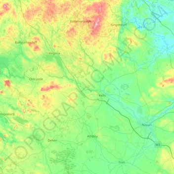
Name: The Municipal District of Kells topographic map, elevation, terrain.
Average elevation: 96 m
Minimum elevation: 22 m
Maximum elevation: 329 m
Other topographic maps
Click on a map to view its topography, its elevation and its terrain.
Scottstown
Scottstown, Rathkenny ED, The Municipal District of Kells, County Meath, Leinster, Ireland
Average elevation: 94 m