
Thank you for supporting this site ❤️
Make a donation
Make a donation
Gear up for your next adventure:
As an Amazon Associate, this site earns from qualifying purchases at no extra cost to you.
Arnozelo topographic map
Click on the map to display elevation.
Thank you for supporting this site ❤️
Make a donation
Make a donation
Gear up for your next adventure:
As an Amazon Associate, this site earns from qualifying purchases at no extra cost to you.
About this map
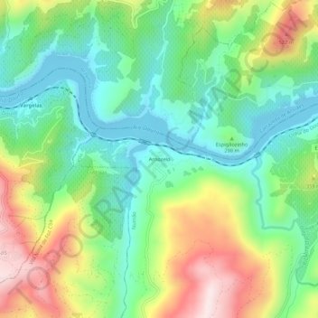
Name: Arnozelo topographic map, elevation, terrain.
Location: Arnozelo, Numão, Vila Nova de Foz Côa, Guarda, Portugal (41.11550 -7.31456 41.15550 -7.27456)
Average elevation: 283 m
Minimum elevation: 104 m
Maximum elevation: 602 m
Thank you for supporting this site ❤️
Make a donation
Make a donation
Gear up for your next adventure:
As an Amazon Associate, this site earns from qualifying purchases at no extra cost to you.