Geolocate

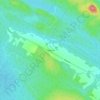
Hartfield topographic map

Click on the map to display elevation.

About this map

Name: Hartfield topographic map, elevation, terrain.

Location: Hartfield, Paroisse de Southampton, Communauté rurale de Nackawic-Millville, Comté d'York, Nouveau-Brunswick, Canada (45.98134 -67.34364 46.05043 -67.28340)

Average elevation: 148 m

Minimum elevation: 77 m

Maximum elevation: 271 m

Other topographic maps

Click on a map to view its topography, its elevation and its terrain.
Gear up for your next adventure:

🦶Hiking Shoe Insoles - Added support for high arches and long days on feet
🥾Waterproof Hiking Shoes - Durable shoes for wet and rugged trails
🎒Backpack Rain Cover - External shield to keep your entire pack dry
🧤Insulated Winter Gloves - Heavy-duty protection for sub-zero Canadian adventures
🧊Insulated Water Bottle - Keeps drinks cold in summer and prevents freezing in winter

As an Amazon Associate, this site earns from qualifying purchases at no extra cost to you.