Geolocate

Tour Salière topographic map

Click on the map to display elevation.

About this map

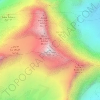
Name: Tour Salière topographic map, elevation, terrain.

Location: Tour Salière, Evionnaz, Saint-Maurice, Wallis, 1902, Switzerland (46.12690 6.92468 46.12700 6.92478)

Average elevation: 2,564 m

Minimum elevation: 1,921 m

Maximum elevation: 3,205 m

Gear up for your next adventure:

🛌Insulated Sleeping Pad - Critical thermal barrier between you and the cold ground
🛶Kayak Dry Bag - Waterproof storage for kayaking adventures
🚲Heavy Duty Bike Lock - Secure your bike at the trailhead or during stops
🥾Trail Hiking Shoes - Durable shoes designed for rugged trails
🎒Hiking Backpack - Lightweight and ergonomic backpacks for day hikes or multi-day treks

As an Amazon Associate, this site earns from qualifying purchases at no extra cost to you.