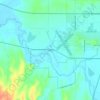
Lake City topographic map
Click on the map to display elevation.
Lake City
Lake City (formerly, Tri-Lake City) is a census-designated place in Modoc County, California, United States. It is located 8.5 miles (14 km) north-northwest of Cedarville, at an elevation of 4,626 feet (1,410 m). Its population is 71 as of the 2020 census, up from 61 from the 2010 census.
About this map

Name: Lake City topographic map, elevation, terrain.
Location: Lake City, Modoc County, California, 96115, United States (41.62514 -120.26174 41.67110 -120.19392)
Average elevation: 1,583 m
Minimum elevation: 1,358 m
Maximum elevation: 2,221 m
Other topographic maps
Click on a map to view its topography, its elevation and its terrain.
Likely
United States > California > Modoc County
Likely (formerly, South Fork) is a census-designated place in Modoc County, California. It is located near the South Fork of the Pit River, 18 miles (29 km) south of the county seat of Alturas, at an elevation of 4,449 feet (1,356 m). Its population is 53 as of the 2020 census, down from 63 at the time of the…
Average elevation: 1,363 m



California Pines
United States > California > Modoc County
California Pines is a census-designated place in Modoc County, California. It lies at an elevation of 4406 feet (1343 m). Its population is 473 as of the 2020 census, down from 520 from the 2010 census.
Average elevation: 1,339 m

Likely
United States > California > Modoc County
Likely (formerly, South Fork) is a census-designated place in Modoc County, California. It is located near the South Fork of the Pit River, 18 miles (29 km) south of the county seat of Alturas, at an elevation of 4,449 feet (1,356 m). Its population is 53 as of the 2020 census, down from 63 at the time of the…
Average elevation: 1,363 m