Geolocate

Pujerra topographic map

Click on the map to display elevation.

About this map

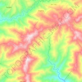
Name: Pujerra topographic map, elevation, terrain.

Location: Pujerra, Serranía de Ronda, Malaga, Andalusia, Spain (36.54337 -5.16644 36.62306 -5.09965)

Average elevation: 748 m

Minimum elevation: 318 m

Maximum elevation: 1,145 m

Other topographic maps

Click on a map to view its topography, its elevation and its terrain.

La Dehesa

Spain > Andalusia > Serranía de Ronda > Gaucín

Average elevation: 241 m

Gear up for your next adventure:

💡LED Headlamp - Hands-free illumination for night hiking and camping
🧣Merino Neck Gaiter - Protects against wind, sun, and cold at high altitudes
💡Solar Camping Lamp - Eco-friendly lighting for campsites
🔋Lithium AA Batteries - Long-lasting power that performs in extreme cold
🧥Packable Rain Jacket - Breathable waterproof layer for unpredictable weather

As an Amazon Associate, this site earns from qualifying purchases at no extra cost to you.