Geolocate

Bex topographic map

Click on the map to display elevation.

About this map

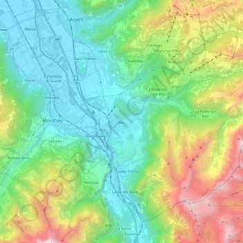
Name: Bex topographic map, elevation, terrain.

Location: Bex, District d'Aigle, Vaud, 1880, Switzerland (46.19896 6.97043 46.30468 7.19696)

Average elevation: 1,153 m

Minimum elevation: 375 m

Maximum elevation: 3,048 m

Other topographic maps

Click on a map to view its topography, its elevation and its terrain.

Villars-sur-Ollon

Switzerland > Vaud > District d'Aigle

Average elevation: 1,293 m

Gear up for your next adventure:

🧊Portable Cooler - Keep food and drinks cold during outdoor adventures
🥾Trail Hiking Shoes - Durable shoes designed for rugged trails
Camping Tent - Weather-resistant tents suitable for 2 to 6 people
🥾Mountain Hiking Boots - High-traction boots for rocky terrain
Tent Footprint - Protect tent floor and increase durability

As an Amazon Associate, this site earns from qualifying purchases at no extra cost to you.