Geolocate

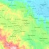
Aurora topographic map

Click on the map to display elevation.

About this map

Name: Aurora topographic map, elevation, terrain.

Location: Aurora, Zamboanga del Sur, Zamboanga Peninsula, 7020, Philippines (7.90861 123.54598 7.98861 123.62598)

Average elevation: 167 m

Minimum elevation: -1 m

Maximum elevation: 310 m

Other topographic maps

Click on a map to view its topography, its elevation and its terrain.
Midsalip

Philippines > Zamboanga del Sur

Average elevation: 363 m

Sominot

Philippines > Zamboanga del Sur

Average elevation: 261 m

Midsalip

Philippines > Zamboanga del Sur

Average elevation: 363 m

Gear up for your next adventure:

🧢Outdoor Cap - Protective cap for sun and rain during hikes
🔋Solar Power Bank - Keep your GPS and devices charged during long outdoor trips
🛶Canoe Life Vest - Safety vest for water sports
⛺Lightweight Backpacking Tent - Compact tent for efficient hiking trips
🧢Hiking Sun Hat - Wide-brimmed protection for exposed mountain ridges

As an Amazon Associate, this site earns from qualifying purchases at no extra cost to you.