
Make a donation
Gear up for your next adventure:
As an Amazon Associate, this site earns from qualifying purchases at no extra cost to you.
Youngsville topographic map
Click on the map to display elevation.
Make a donation
Gear up for your next adventure:
As an Amazon Associate, this site earns from qualifying purchases at no extra cost to you.
About this map
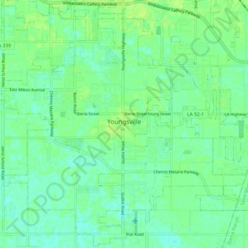
Name: Youngsville topographic map, elevation, terrain.
Average elevation: 10 m
Minimum elevation: 4 m
Maximum elevation: 14 m
Make a donation
Gear up for your next adventure:
As an Amazon Associate, this site earns from qualifying purchases at no extra cost to you.
Other topographic maps
Click on a map to view its topography, its elevation and its terrain.
Lafayette
United States > Louisiana > Lafayette Parish > Lafayette
Lafayette lies approximately 135 miles (217 km) from New Orleans, 59 miles (95 km) from the state capital of Baton Rouge, 75 miles (121 km) from Lake Charles, and 89 miles (143 km) from Alexandria. The city has an elevation ranging from 36 feet (11.0 m) to 49 feet (15 m) above sea level. According to the…
Average elevation: 9 m
Youngsville
United States > Louisiana > Lafayette Parish > Youngsville > Youngsville
Average elevation: 10 m
Make a donation
Gear up for your next adventure:
As an Amazon Associate, this site earns from qualifying purchases at no extra cost to you.