Geolocate

Bambang topographic map

Click on the map to display elevation.

About this map

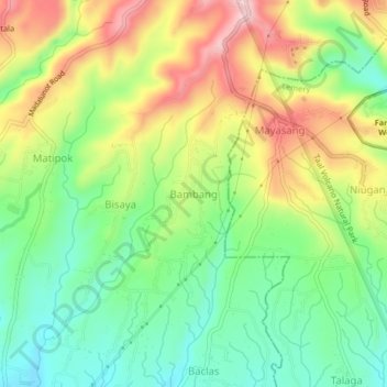
Name: Bambang topographic map, elevation, terrain.

Location: Bambang, Calaca, Batangas, Calabarzon, 4212, Philippines (13.98937 120.83456 14.02937 120.87456)

Average elevation: 357 m

Minimum elevation: 253 m

Maximum elevation: 501 m

Gear up for your next adventure:

🪑Ultralight Camping Stool - Compact seating for rest stops during long hikes
🐕Hiking Dog Pack - Let your canine companion carry their own water and food
🧼Travel Hand Sanitizer - Keep hands clean when water is scarce
🧦Crew Hiking Socks - Comfortable socks for long-distance hikes
🥾Mountain Hiking Shoes - Shoes with superior grip for mountainous terrain

As an Amazon Associate, this site earns from qualifying purchases at no extra cost to you.