Geolocate

Godamguda topographic map

Click on the map to display elevation.

About this map

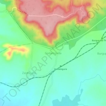
Name: Godamguda topographic map, elevation, terrain.

Location: Godamguda, Vikarabad mandal, Vikarabad, Telangana, India (17.27503 77.84380 17.31503 77.88380)

Average elevation: 609 m

Minimum elevation: 554 m

Maximum elevation: 705 m

Gear up for your next adventure:

Lightweight Camping Tent - Portable shelter optimized for Canadian backcountry camping
🥘Camping Cookware Set - Compact nesting pots and pans for trail cooking
💧Hydration Pack - Hands-free hydration system for long hikes
📷Outdoor Action Camera - Capture high-elevation views and rugged adventures
🧤Rechargeable Heated Gloves - Extreme warmth for Canadian winter expeditions

As an Amazon Associate, this site earns from qualifying purchases at no extra cost to you.