Geolocate

Gala topographic map

Click on the map to display elevation.

About this map

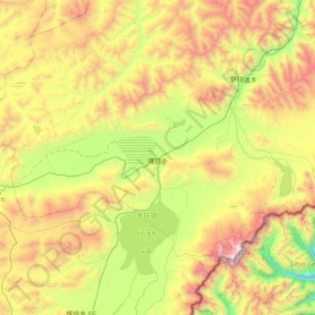
Name: Gala topographic map, elevation, terrain.

Location: Gala, Kangmar County, Shigatse Prefecture, Tibet, China (28.09348 89.01793 28.44098 89.64552)

Average elevation: 4,782 m

Minimum elevation: 3,703 m

Maximum elevation: 6,531 m

Gear up for your next adventure:

💧Collapsible Water Bottle - Space-saving water bottle for outdoor activities
🔪Outdoor Multitool - Versatile tool for repairs and food prep in the wild
🧊Portable Cooler - Keep food and drinks cold during outdoor adventures
🔭Outdoor Binoculars - Lightweight binoculars for birdwatching and hiking
🥫Freeze-Dried Meals - Lightweight, high-calorie nutrition for multi-day treks

As an Amazon Associate, this site earns from qualifying purchases at no extra cost to you.