Geolocate

Tugatog topographic map

Click on the map to display elevation.

About this map

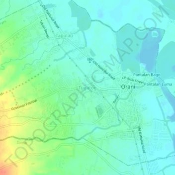
Name: Tugatog topographic map, elevation, terrain.

Location: Tugatog, Orani, Bataan, Central Luzon, 2122, Philippines (14.78098 120.50658 14.82098 120.54658)

Average elevation: 13 m

Minimum elevation: 0 m

Maximum elevation: 47 m

Gear up for your next adventure:

🧼Travel Hand Sanitizer - Keep hands clean when water is scarce
🔭Compact Binoculars - Lightweight optics for scouting trails and wildlife
🌬️Windproof Camp Stove - Efficient cooking even on exposed mountain peaks
💧Hydration Pack - Hands-free hydration system for long hikes
🛁Quick-Dry Microfiber Towel - Space-saving towel that dries rapidly on the move

As an Amazon Associate, this site earns from qualifying purchases at no extra cost to you.