
Thank you for supporting this site ❤️
Make a donation
Make a donation
Gear up for your next adventure:
As an Amazon Associate, this site earns from qualifying purchases at no extra cost to you.
Bugeng'i topographic map
Click on the map to display elevation.
Thank you for supporting this site ❤️
Make a donation
Make a donation
Gear up for your next adventure:
As an Amazon Associate, this site earns from qualifying purchases at no extra cost to you.
About this map
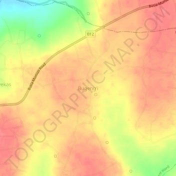
Name: Bugeng'i topographic map, elevation, terrain.
Location: Bugeng'i, Bukhayo West ward, Matayos, Busia County, Kenya (0.42899 34.15005 0.46899 34.19005)
Average elevation: 1,207 m
Minimum elevation: 1,163 m
Maximum elevation: 1,224 m
Thank you for supporting this site ❤️
Make a donation
Make a donation
Gear up for your next adventure:
As an Amazon Associate, this site earns from qualifying purchases at no extra cost to you.