Geolocate

Shohola topographic map

Click on the map to display elevation.

About this map

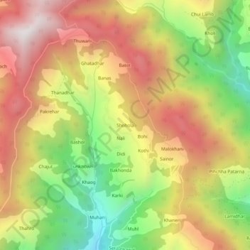
Name: Shohola topographic map, elevation, terrain.

Location: Shohola, Ani, Kullu District, Himachal Pradesh, 172026, India (31.48116 77.35396 31.52116 77.39396)

Average elevation: 2,422 m

Minimum elevation: 1,782 m

Maximum elevation: 3,008 m

Gear up for your next adventure:

🥾Trail Hiking Shoes - Durable shoes designed for rugged trails
🥘Camping Cookware Set - Compact nesting pots and pans for trail cooking
💧Filtered Water Bottle - Safe drinking water on the go
👟Sport Hiking Sandals - Breathable footwear for water crossings and camp rest
🧣Evaporative Cooling Towel - Beat the heat during intense summer climbs

As an Amazon Associate, this site earns from qualifying purchases at no extra cost to you.