Geolocate

Trevlac topographic map

Click on the map to display elevation.

About this map

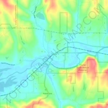
Name: Trevlac topographic map, elevation, terrain.

Location: Trevlac, Brown County, Indiana, 47435, United States (39.24560 -86.35694 39.28560 -86.31694)

Average elevation: 214 m

Minimum elevation: 188 m

Maximum elevation: 262 m

Gear up for your next adventure:

🧭Orienteering Kit - Tools for map reading and navigation in the wild
🥾Hiking Shorts - Breathable shorts suitable for summer hikes
🚲Bike Repair Kit - Essential tools for on-trail mechanical issues
🥾Trail Running Boots - Durable shoes designed for trail running
🧢Hiking Hat - Sun-protective and breathable hats for long treks

As an Amazon Associate, this site earns from qualifying purchases at no extra cost to you.