
Thank you for supporting this site ❤️
Make a donation
Make a donation
Gear up for your next adventure:
As an Amazon Associate, this site earns from qualifying purchases at no extra cost to you.
Cheneux topographic map
Click on the map to display elevation.
Thank you for supporting this site ❤️
Make a donation
Make a donation
Gear up for your next adventure:
As an Amazon Associate, this site earns from qualifying purchases at no extra cost to you.
About this map
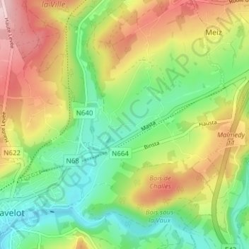
Name: Cheneux topographic map, elevation, terrain.
Location: Cheneux, Stavelot, Verviers, Liège, Wallonia, 4970, Belgium (50.38832 5.94044 50.42832 5.98044)
Average elevation: 370 m
Minimum elevation: 273 m
Maximum elevation: 506 m
Thank you for supporting this site ❤️
Make a donation
Make a donation
Gear up for your next adventure:
As an Amazon Associate, this site earns from qualifying purchases at no extra cost to you.