Geolocate

Forest Junction topographic map

Click on the map to display elevation.

About this map

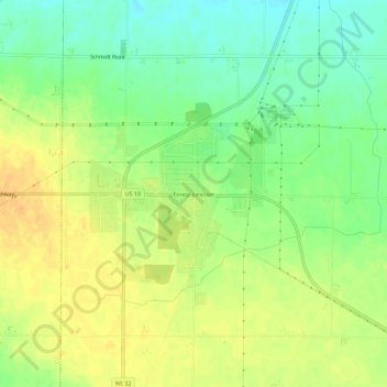
Name: Forest Junction topographic map, elevation, terrain.

Location: Forest Junction, Town of Brillion, Calumet County, Wisconsin, 54123, United States (44.19249 -88.16427 44.23249 -88.12427)

Average elevation: 252 m

Minimum elevation: 234 m

Maximum elevation: 267 m

Other topographic maps

Click on a map to view its topography, its elevation and its terrain.

Hilbert

United States > Wisconsin > Calumet County

Average elevation: 258 m

Potter

United States > Wisconsin > Calumet County

Average elevation: 252 m

Sherwood

United States > Wisconsin > Calumet County

Average elevation: 265 m

Stockbridge

United States > Wisconsin > Calumet County

Average elevation: 261 m

Chilton

United States > Wisconsin > Calumet County

Average elevation: 275 m

Gear up for your next adventure:

Camping Groundsheet - Protect your tent from moisture and dirt
🥾Hiking Shoes - Durable and comfortable shoes for trail hiking
Camping Essentials - All-in-one gear for a comfortable camping trip
Camping Tent - Weather-resistant tents suitable for 2 to 6 people
🥾Lightweight Hiking Boots - Boots for comfort and mobility on long hikes

As an Amazon Associate, this site earns from qualifying purchases at no extra cost to you.