Geolocate

Hilltown topographic map

Click on the map to display elevation.

About this map

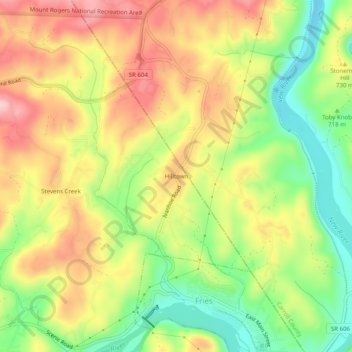
Name: Hilltown topographic map, elevation, terrain.

Location: Hilltown, Grayson County, Virginia, 24330, United States (36.71040 -81.00258 36.75040 -80.96258)

Average elevation: 727 m

Minimum elevation: 632 m

Maximum elevation: 820 m

Gear up for your next adventure:

🛏️Camping Sleeping Mat - Comfortable mats for sleeping outdoors
Lightweight Backpacking Tent - Compact tent for efficient hiking trips
🧢Sun Protection Cap - Breathable cap to protect from sun exposure
🔭Compact Binoculars - Lightweight optics for scouting trails and wildlife
🧤Insulated Winter Gloves - Heavy-duty protection for sub-zero Canadian adventures

As an Amazon Associate, this site earns from qualifying purchases at no extra cost to you.