Geolocate

Patitinan topographic map

Click on the map to display elevation.

About this map

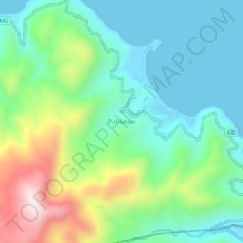
Name: Patitinan topographic map, elevation, terrain.

Location: Patitinan, Sagñay, Camarines Sur, Bicol Region, Philippines (13.52035 123.55706 13.56035 123.59706)

Average elevation: 195 m

Minimum elevation: -2 m

Maximum elevation: 669 m

Other topographic maps

Click on a map to view its topography, its elevation and its terrain.

San Roque

Philippines > Camarines Sur > Sagñay

Average elevation: 13 m

Gear up for your next adventure:

🥾Lightweight Hiking Shoes - Comfortable shoes for day hikes
Camping Groundsheet - Protect your tent from moisture and dirt
💧Collapsible Water Bottle - Space-saving water bottle for outdoor activities
🧰Emergency Multi-Tool - Compact multi-tool for outdoor survival
🧼Travel Hand Sanitizer - Keep hands clean when water is scarce

As an Amazon Associate, this site earns from qualifying purchases at no extra cost to you.