Geolocate

Torrijos topographic map

Click on the map to display elevation.

About this map

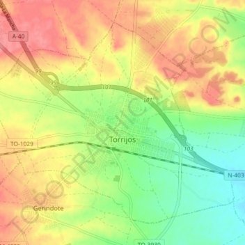
Name: Torrijos topographic map, elevation, terrain.

Location: Torrijos, Toledo, Castile-La Mancha, 45500, Spain (39.96215 -4.31943 40.00725 -4.24781)

Average elevation: 537 m

Minimum elevation: 499 m

Maximum elevation: 571 m

Gear up for your next adventure:

🧴Insect Repellent - Protect yourself from bugs during outdoor adventures
🦯Trekking Poles - Reduced impact on joints for steep topographic climbs
🧦Thermal Socks - Warm socks for winter hiking or camping
🧥Packable Rain Jacket - Breathable waterproof layer for unpredictable weather
🥾Lightweight Hiking Boots - Boots for comfort and mobility on long hikes

As an Amazon Associate, this site earns from qualifying purchases at no extra cost to you.