Geolocate

Bloomfield topographic map

Click on the map to display elevation.

About this map

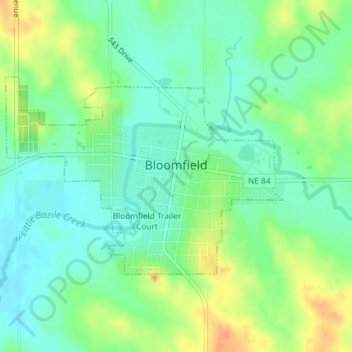
Name: Bloomfield topographic map, elevation, terrain.

Location: Bloomfield, Knox County, Nebraska, 68718, United States (42.59044 -97.66342 42.60563 -97.63442)

Average elevation: 527 m

Minimum elevation: 510 m

Maximum elevation: 556 m

Other topographic maps

Click on a map to view its topography, its elevation and its terrain.

Gear up for your next adventure:

🧴Outdoor Sunscreen - High SPF protection for high-altitude UV exposure
🥾Mountain Trail Shoes - High-traction shoes for mountain trails
🛶Kayak Dry Bag - Waterproof storage for kayaking adventures
💧Reusable Water Bottle - Durable water bottles for hydration on trails
🧦Hiking Liner Socks - Thin base layer to prevent friction and blisters

As an Amazon Associate, this site earns from qualifying purchases at no extra cost to you.