
Thank you for supporting this site ❤️
Make a donation
Make a donation
Gear up for your next adventure:
As an Amazon Associate, this site earns from qualifying purchases at no extra cost to you.
Puławy topographic map
Click on the map to display elevation.
Thank you for supporting this site ❤️
Make a donation
Make a donation
Gear up for your next adventure:
As an Amazon Associate, this site earns from qualifying purchases at no extra cost to you.
About this map
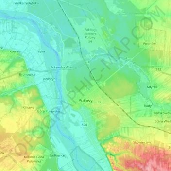
Name: Puławy topographic map, elevation, terrain.
Location: Puławy, Puławy County, Lublin Voivodeship, 24-111, Poland (51.37089 21.92489 51.48228 22.02955)
Average elevation: 140 m
Minimum elevation: 110 m
Maximum elevation: 223 m
Thank you for supporting this site ❤️
Make a donation
Make a donation
Gear up for your next adventure:
As an Amazon Associate, this site earns from qualifying purchases at no extra cost to you.