Geolocate

Upland topographic map

Click on the map to display elevation.

About this map

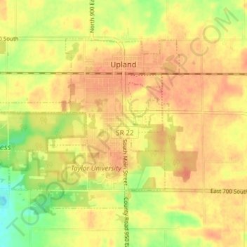
Name: Upland topographic map, elevation, terrain.

Location: Upland, Grant County, Indiana, 46989, United States (40.44847 -85.54168 40.48039 -85.48063)

Average elevation: 278 m

Minimum elevation: 250 m

Maximum elevation: 291 m

Other topographic maps

Click on a map to view its topography, its elevation and its terrain.

Jalapa

United States > Indiana > Grant County

Average elevation: 247 m

Gear up for your next adventure:

🦶Hiking Shoe Insoles - Added support for high arches and long days on feet
🔋Emergency Crank Radio - Weather alerts and power without needing batteries
🥾Lightweight Hiking Shoes - Comfortable shoes for day hikes
🥾Light Trekking Boots - Supportive boots for multi-day treks
🎒Hiking Daypack - Lightweight and durable backpacks for day trips and excursions

As an Amazon Associate, this site earns from qualifying purchases at no extra cost to you.