
Eppenbrunn topographic map
Click on the map to display elevation.
About this map
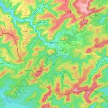
Name: Eppenbrunn topographic map, elevation, terrain.
Average elevation: 348 m
Minimum elevation: 260 m
Maximum elevation: 466 m
Other topographic maps
Click on a map to view its topography, its elevation and its terrain.
Monbijou
Germany > Rhineland-Palatinate > Südwestpfalz > Dietrichingen > Monbijou
Average elevation: 302 m
Waldfischbach
Germany > Rhineland-Palatinate > Südwestpfalz > Waldfischbach-Burgalben
Average elevation: 326 m
Berwartstein
Germany > Rhineland-Palatinate > Südwestpfalz > Erlenbach bei Dahn
Average elevation: 278 m