Geolocate

Santa Cruz Xitla topographic map

Click on the map to display elevation.

About this map

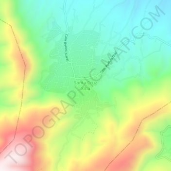
Name: Santa Cruz Xitla topographic map, elevation, terrain.

Location: Santa Cruz Xitla, Oaxaca, Mexico (16.30139 -96.69222 16.34139 -96.65222)

Average elevation: 1,891 m

Minimum elevation: 1,597 m

Maximum elevation: 2,358 m

Gear up for your next adventure:

🚲Handlebar Phone Mount - View topographic-map.com live while cycling
🕶️Polarized Sunglasses - Reduces glare from snow and water at high elevations
🧊Portable Cooler - Keep food and drinks cold during outdoor adventures
🧶550 Survival Paracord - Versatile utility cord for emergency repairs and rigging
🧭Orienteering Kit - Tools for map reading and navigation in the wild

As an Amazon Associate, this site earns from qualifying purchases at no extra cost to you.