
Meuro topographic map
Interactive map
Click on the map to display elevation.
About this map
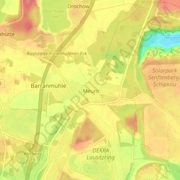
Name: Meuro topographic map, elevation, terrain.
Location: Meuro, Oberspreewald-Lausitz, Brandenburg, 01994, Deutschland (51.52844 13.90848 51.56844 13.94848)
Average elevation: 122 m
Minimum elevation: 79 m
Maximum elevation: 150 m