
Barces topographic map
Click on the map to display elevation.
About this map
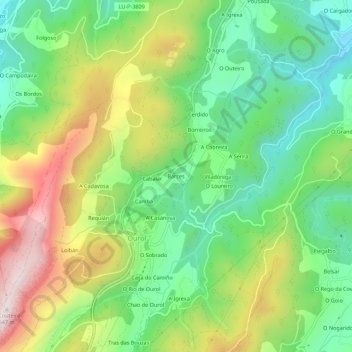
Name: Barces topographic map, elevation, terrain.
Location: Barces, Ourol, Mariña Occidental, Lugo, Galicia, 27865, España (43.55105 -7.65638 43.59105 -7.61638)
Average elevation: 290 m
Minimum elevation: 68 m
Maximum elevation: 640 m
Other topographic maps
Click on a map to view its topography, its elevation and its terrain.