
Surat topographic map
Interactive map
Click on the map to display elevation.
About this map
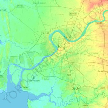
Name: Surat topographic map, elevation, terrain.
Location: Surat, Gujarat, 395001, Inde (21.02646 72.64813 21.34646 72.96813)
Average elevation: 11 m
Minimum elevation: -3 m
Maximum elevation: 33 m