Geolocate

Schotten topographic map

Click on the map to display elevation.

About this map

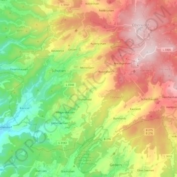
Name: Schotten topographic map, elevation, terrain.

Location: Schotten, Vogelsbergkreis, Hesse, 63679, Germany (50.42423 9.04027 50.54947 9.27064)

Average elevation: 430 m

Minimum elevation: 156 m

Maximum elevation: 772 m

Gear up for your next adventure:

🧢Sun Protection Cap - Breathable cap to protect from sun exposure
Camping Essentials - All-in-one gear for a comfortable camping trip
🥾Approach Shoes - Shoes designed for climbing approaches and rugged trails
🧴Insect Repellent - Protect yourself from bugs during outdoor adventures
🥾Light Trekking Boots - Supportive boots for multi-day treks

As an Amazon Associate, this site earns from qualifying purchases at no extra cost to you.