Geolocate

Deer Park topographic map

Click on the map to display elevation.

About this map
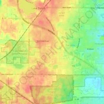
Name: Deer Park topographic map, elevation, terrain.

Location: Deer Park, Ela Township, Lake County, Illinois, United States (42.15211 -88.12955 42.18500 -88.03867)

Average elevation: 253 m

Minimum elevation: 223 m

Maximum elevation: 276 m

Other topographic maps

Click on a map to view its topography, its elevation and its terrain.
Third Lake

United States > Illinois > Lake County > Third Lake

Average elevation: 236 m

Gear up for your next adventure:

🦶Hiking Shoe Insoles - Added support for high arches and long days on feet
⛺Backpacking Tent - Lightweight tent for long-distance hiking trips
🧴Bear Spray Holster - Quick-access carry for essential Canadian wilderness safety
🌬️Windproof Camp Stove - Efficient cooking even on exposed mountain peaks
🧣Evaporative Cooling Towel - Beat the heat during intense summer climbs

As an Amazon Associate, this site earns from qualifying purchases at no extra cost to you.