Geolocate

La Sure topographic map

Click on the map to display elevation.

About this map

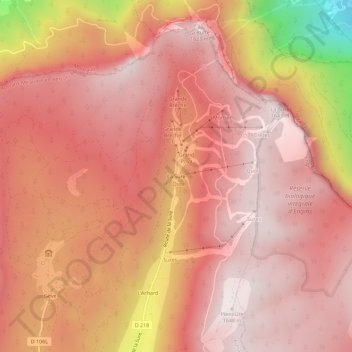
Name: La Sure topographic map, elevation, terrain.

Location: La Sure, Autrans, Autrans-Méaudre en Vercors, Grenoble, Isère, Auvergne-Rhône-Alpes, France métropolitaine, 38880, France (45.20696 5.56065 45.24696 5.60065)

Average elevation: 1,361 m

Minimum elevation: 555 m

Maximum elevation: 1,646 m

Other topographic maps

Click on a map to view its topography, its elevation and its terrain.

Gear up for your next adventure:

🪑Insulated Seat Pad - Protect your seat from cold rocks and wet logs
🧼Biodegradable Camp Soap - Environmentally friendly cleaning for gear and body
🦶Anti-Blister Balm - Prevents friction and hotspots during long ascents
🧊Portable Cooler - Keep food and drinks cold during outdoor adventures
🥾Hiking Shoes - Durable and comfortable shoes for trail hiking

As an Amazon Associate, this site earns from qualifying purchases at no extra cost to you.