
Chillán topographic map
Interactive map
Click on the map to display elevation.
About this map
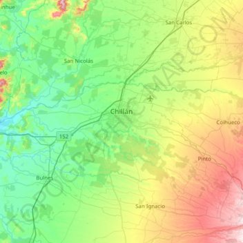
Name: Chillán topographic map, elevation, terrain.
Location: Chillán, Provincia de Diguillín, Ñuble, Chili (-36.75042 -72.47298 -36.50837 -71.85587)
Average elevation: 166 m
Minimum elevation: 33 m
Maximum elevation: 510 m
Other topographic maps
Click on a map to view its topography, its elevation and its terrain.
Chillán
Chili > Ñuble > Provincia de Diguillín > Chillán
Chillán, Provincia de Diguillín, Ñuble, 056, Chili
Average elevation: 139 m
Bulnes
Chili > Ñuble > Provincia de Diguillín
Bulnes, Provincia de Diguillín, Ñuble, 3930000, Chili
Average elevation: 102 m