Geolocate

Marianitas topographic map

Click on the map to display elevation.

About this map

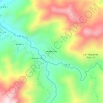
Name: Marianitas topographic map, elevation, terrain.

Location: Marianitas, Nanegal, Quito Canton, Pichincha, Ecuador (0.10963 -78.67608 0.14963 -78.63608)

Average elevation: 1,338 m

Minimum elevation: 1,034 m

Maximum elevation: 1,732 m

Gear up for your next adventure:

🥾Trail Hiking Boots - Supportive boots for rough trails
🔦LED Headtorch - Bright and durable light for night activities
🛶Kayak Accessories - Essential gear for safe and fun kayaking adventures
🧥Ultralight Puffy Jacket - Maximum warmth that packs down to the size of an orange
📷Outdoor Action Camera - Capture high-elevation views and rugged adventures

As an Amazon Associate, this site earns from qualifying purchases at no extra cost to you.