Geolocate

Valkenburg topographic map

Click on the map to display elevation.

About this map

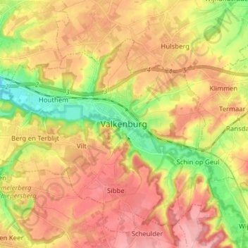
Name: Valkenburg topographic map, elevation, terrain.

Location: Valkenburg, Limburg, Netherlands, 6301, Netherlands (50.82475 5.79125 50.90475 5.87125)

Average elevation: 121 m

Minimum elevation: 52 m

Maximum elevation: 177 m

Gear up for your next adventure:

🧰Emergency Multi-Tool - Compact multi-tool for outdoor survival
🧦Outdoor Socks - Durable socks designed for hiking and outdoor sports
🚲MTB Frame Bag - Carry tools and maps directly on your bicycle frame
🥾Waterproof Trail Shoes - Shoes designed to handle wet terrain
💧Hydration Bladder - Hands-free hydration solution for long treks

As an Amazon Associate, this site earns from qualifying purchases at no extra cost to you.