

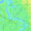
Floral Bluff topographic map
Click on the map to display elevation.
About this map

Name: Floral Bluff topographic map, elevation, terrain.
Average elevation: 8 m
Minimum elevation: -8 m
Maximum elevation: 21 m
Other topographic maps
Click on a map to view its topography, its elevation and its terrain.


Pumpkin Hill Creek Preserve State Park
United States > Florida > Duval County > Jacksonville
Average elevation: 4 m
Williamson Creek
United States > Florida > Duval County > Jacksonville > Cedar Hills Estates
Average elevation: 11 m

Isle of Palms Park
United States > Florida > Duval County > Jacksonville > Isle of Palms
Average elevation: 3 m