
Thank you for supporting this site ❤️
Make a donation
Make a donation
Gear up for your next adventure:
As an Amazon Associate, this site earns from qualifying purchases at no extra cost to you.
Kalkere topographic map
Click on the map to display elevation.
Thank you for supporting this site ❤️
Make a donation
Make a donation
Gear up for your next adventure:
As an Amazon Associate, this site earns from qualifying purchases at no extra cost to you.
About this map
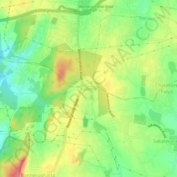
Name: Kalkere topographic map, elevation, terrain.
Location: Kalkere, Anekal, Bangalore Urban, Karnataka, 560108, India (12.81281 77.57069 12.85281 77.61069)
Average elevation: 928 m
Minimum elevation: 882 m
Maximum elevation: 986 m
Thank you for supporting this site ❤️
Make a donation
Make a donation
Gear up for your next adventure:
As an Amazon Associate, this site earns from qualifying purchases at no extra cost to you.