Geolocate

Orosa topographic map

Click on the map to display elevation.

About this map

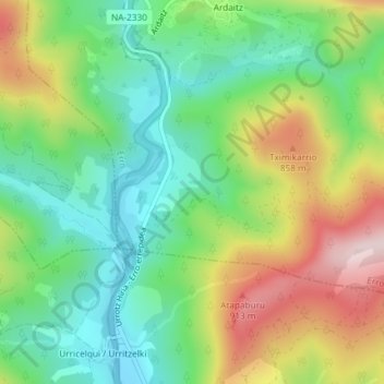
Name: Orosa topographic map, elevation, terrain.

Location: Orosa, Erro, Pirinioak, Navarre, 31697, Spain (42.87217 -1.47215 42.89217 -1.45215)

Average elevation: 713 m

Minimum elevation: 568 m

Maximum elevation: 947 m

Gear up for your next adventure:

🧥Thermal Layer - Insulating layer for cold outdoor conditions
🧼Travel Hand Sanitizer - Keep hands clean when water is scarce
🧦Thermal Socks - Warm socks for winter hiking or camping
🧦Crew Hiking Socks - Comfortable socks for long-distance hikes
🛶Kayak Accessories - Essential gear for safe and fun kayaking adventures

As an Amazon Associate, this site earns from qualifying purchases at no extra cost to you.