Geolocate

The Hamptons topographic map

Click on the map to display elevation.

About this map

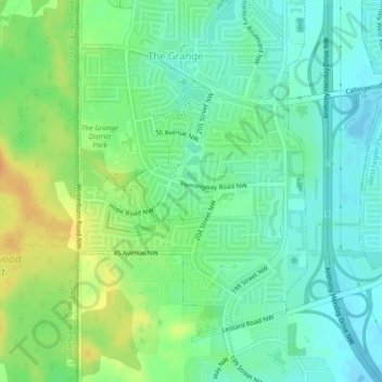
Name: The Hamptons topographic map, elevation, terrain.

Location: The Hamptons, The Grange, Edmonton, Alberta, Canada (53.47722 -113.68908 53.49775 -113.66188)

Average elevation: 700 m

Minimum elevation: 687 m

Maximum elevation: 721 m

Alberta trails, hiking, mountain biking, running and outdoor activities

Other topographic maps

Click on a map to view its topography, its elevation and its terrain.

William Hawrelak Park

Canada > Alberta > Edmonton

Average elevation: 649 m

Horseshoe Lake

Canada > Alberta > Edmonton

Average elevation: 680 m

McQueen Park

Canada > Alberta > Edmonton

Average elevation: 674 m

landslide

Canada > Alberta > Edmonton

Average elevation: 668 m

landslide

Canada > Alberta > Edmonton

Average elevation: 668 m

Ormsby Park

Canada > Alberta > Edmonton

Average elevation: 688 m

Gear up for your next adventure:

🦌Outdoor Trail Camera - Monitor wildlife activity near your favorite spots
🧥Waterproof Jacket - Lightweight rain jackets for hiking and outdoor activities
🧥Thermal Layer - Insulating layer for cold outdoor conditions
🧥Fleece Jacket - Warm and lightweight jacket for layering
🥾Trail Hiking Shoes - Durable shoes designed for rugged trails

As an Amazon Associate, this site earns from qualifying purchases at no extra cost to you.