Geolocate

Huanchay topographic map

Click on the map to display elevation.

About this map

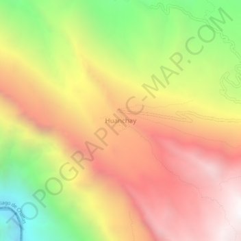
Name: Huanchay topographic map, elevation, terrain.

Location: Huanchay, Santiago de Challas, Pataz, La Libertad, Perú (-8.44565 -77.40801 -8.40565 -77.36801)

Average elevation: 2,847 m

Minimum elevation: 1,670 m

Maximum elevation: 3,813 m

Gear up for your next adventure:

💡LED Camping Lantern - Illuminate your campsite with long-lasting lanterns
💡Portable Camping Lamp - Rechargeable lamp for campsite lighting
🧥Softshell Jacket - Windproof and breathable jacket for hiking
🧥Insulated Jacket - Keep warm in cold outdoor conditions
🚲Handlebar Phone Mount - View topographic-map.com live while cycling

As an Amazon Associate, this site earns from qualifying purchases at no extra cost to you.