Geolocate

Maram topographic map

Click on the map to display elevation.

About this map

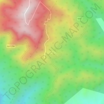
Name: Maram topographic map, elevation, terrain.

Location: Maram, Senapati tehsil, Senapati, Manipur, India (25.39425 94.07535 25.43425 94.11535)

Average elevation: 1,399 m

Minimum elevation: 1,003 m

Maximum elevation: 1,875 m

Gear up for your next adventure:

💡LED Camping Lantern - Illuminate your campsite with long-lasting lanterns
🦶Hiking Shoe Insoles - Added support for high arches and long days on feet
🧥Waterproof Jacket - Lightweight rain jackets for hiking and outdoor activities
🔥Emergency Fire Starter - Reliable ignition source for all weather conditions
🧤Rechargeable Heated Gloves - Extreme warmth for Canadian winter expeditions

As an Amazon Associate, this site earns from qualifying purchases at no extra cost to you.