Geolocate

Snye topographic map

Click on the map to display elevation.

About this map

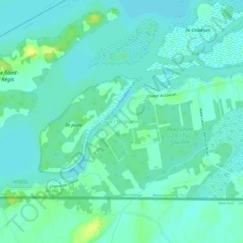
Name: Snye topographic map, elevation, terrain.

Location: Snye, Le Haut-Saint-Laurent, Montérégie, Quebec, Canada (44.99196 -74.62782 45.03196 -74.58782)

Average elevation: 49 m

Minimum elevation: 43 m

Maximum elevation: 63 m

Le Haut-Saint-Laurent trails, hiking, mountain biking, running and outdoor activities

Gear up for your next adventure:

🧥Softshell Jacket - Windproof and breathable jacket for hiking
🧰Multitool Knife - Compact and versatile tool for outdoor use
🧢Hiking Sun Hat - Wide-brimmed protection for exposed mountain ridges
🧦Crew Hiking Socks - Comfortable socks for long-distance hikes
🧦Hiking Liner Socks - Thin base layer to prevent friction and blisters

As an Amazon Associate, this site earns from qualifying purchases at no extra cost to you.