Geolocate

Coolidge topographic map

Click on the map to display elevation.

About this map

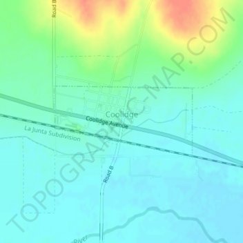
Name: Coolidge topographic map, elevation, terrain.

Location: Coolidge, Hamilton County, Kansas, 67836, United States (38.03693 -102.01835 38.04481 -101.99883)

Average elevation: 1,027 m

Minimum elevation: 1,014 m

Maximum elevation: 1,062 m

Gear up for your next adventure:

🥾All-Terrain Hiking Boots - Versatile boots for varied hiking conditions
🧊Portable Cooler - Keep food and drinks cold during outdoor adventures
🥫Freeze-Dried Meals - Lightweight, high-calorie nutrition for multi-day treks
🧴Sunscreen SPF - Broad-spectrum sunscreen for outdoor activities
🧦Crew Hiking Socks - Comfortable socks for long-distance hikes

As an Amazon Associate, this site earns from qualifying purchases at no extra cost to you.